UP TCAGP Releases Taal Open LiDAR Data
- Posted by
- on 28 January 2020
- 0 Comments
With the Philippines being at constant risk from natural disasters, the UP Training Center for Applied Geodesy and Photogrammetry (UP TCAGP) is aware that adequate data is needed for disaster risk reduction planning and operations. And as an institution mandated to provide training and research services on geomatics, the UP TCAGP is equipped with the capacity to generate geospatial data for mapping and planning purposes.
Read the full postUP PHIL-LiDAR 1 PROGRAM Technical Reports
- Posted by Aian Perucho
- on 9 February 2018
- 0 Comments
"In the midst of a changing environment era is a harbinger of worse situations that are to come. Typhoons and floods are expected to increase in number and intensity, exposing island-states like the Philippines to further vulnerability."
Read the full postUP Phil-LiDAR 1 Program Closes with Culminating Conference
- Posted by Bryle Leaño and Aian Perucho
- on 18 December 2017
- 0 Comments
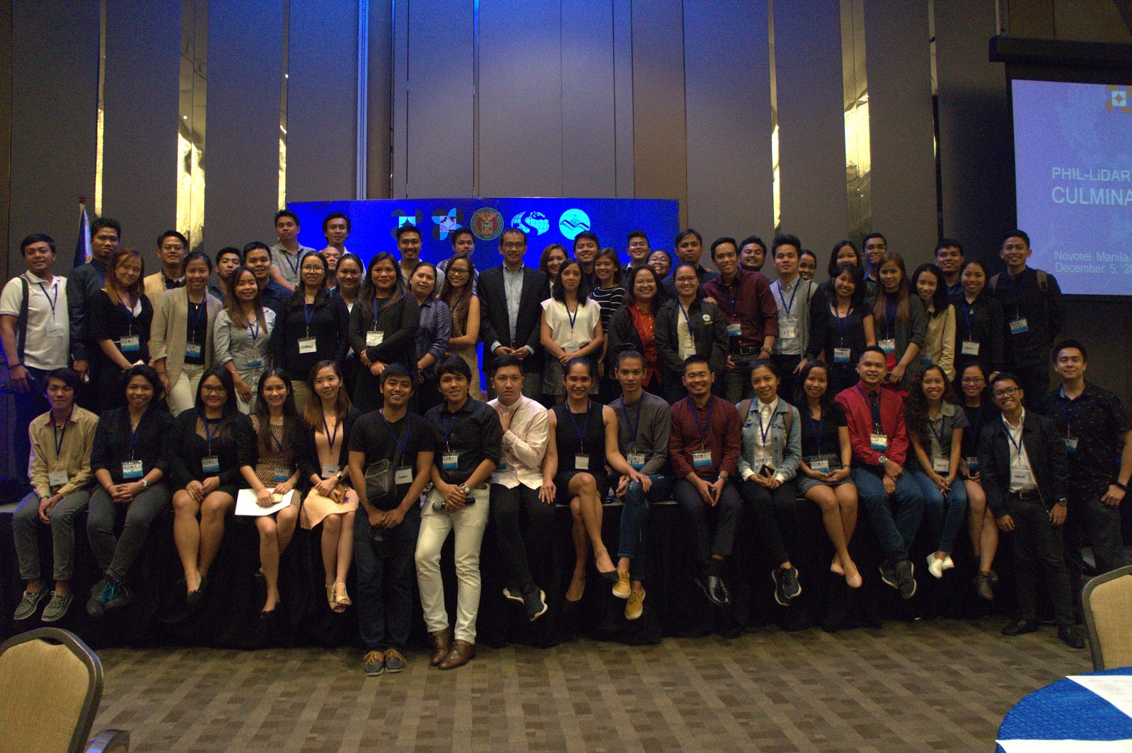
The Phil-LiDAR 1 Program closed the project with a culminating conference last December 5, 2017. The event was graced by various sectors, such as Local Government Units, State Universities and Colleges, Higher Education Institutions, National Government Agencies, Non-Government Organizations, and distinguished individuals, which were partners of the program. Representatives from each sectors were asked to present a talk on how the LiDAR Data was able to help them improve their nature of work and further improve their knowledge on Disaster Risk Reduction Management and Flood Hazard Mapping.
Read the full postJalajala Local Government Visits Phi-LiDAR 1 Office
- Posted by Bryle Leaño
- on 7 December 2017
- 0 Comments
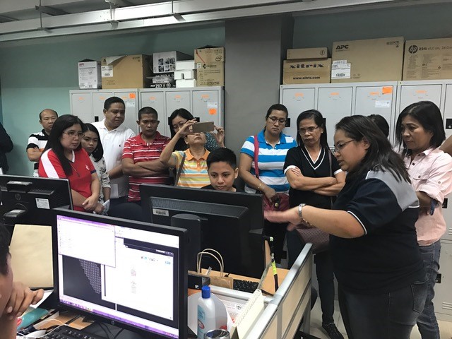
The Local Government Unit (LGU) of the Municipality of Jalajala conducted an office visit at the UP Phil-LiDAR 1 Program last November 22, 2017. Representatives from the various departments of the LGU such as Engineering, Assesor’s Office, MHO, MSWDO, MCRO, GSO, MPDC, and Budget were present. The team was headed by the Municipal Administrator Mr. Elmer Pillas. In attendance also were Engineer Ofelia Candelaria, Dr. Pedro Benigno Beltran, Engineer Diana Joie Laspobres, Ms. Lani dela Cruz, Mr. Reynante R. Beraña, Ms. Trixie Vidallo, Ms. Princesita MM. Sinuhin, Ms. Karen L. Viterbo, and Ms. Nancy Labro. The office visit aimed to show how the LiDAR Program operates and discuss the benefits of the data being provided by the program. The visit also cascaded information to the Municipality of Jalajala with regards to their own specific area, with the Digital Elevation Model (DEM) of their locality shown to the participants during the office tour.
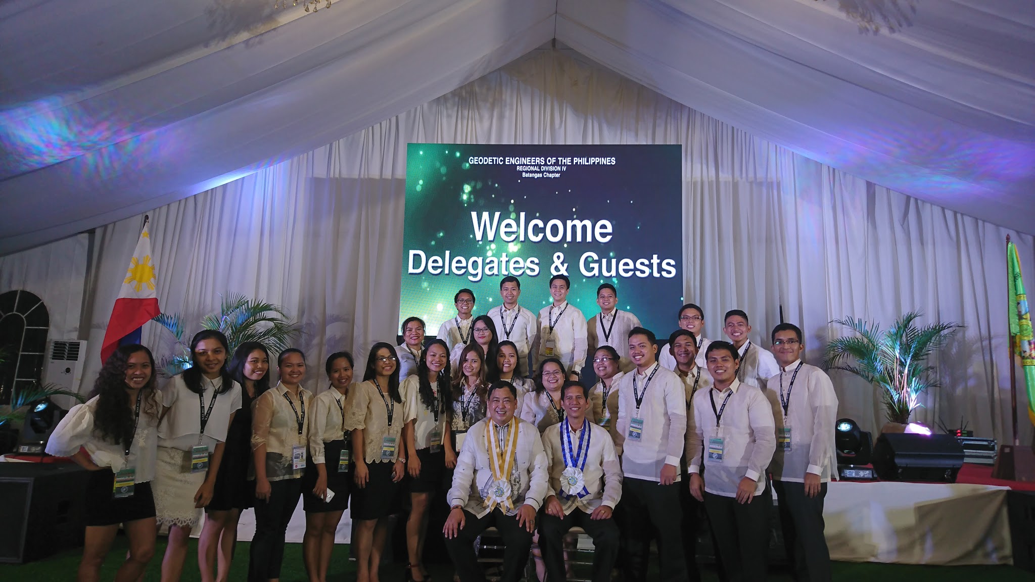
Read the full postUP Phil- LiDAR 1 Program staff invites in the 34th GEP South Luzon Area Assembly in Nasugbu, Batangas
- Posted by Engr. Regis Guhiting
- on 21 October 2017
- 0 Comments
The Geodetic Engineers of the Philippines, Inc. (GEP) South Luzon Area Assembly was held last October 20-21, 2017 in Nasugbu, Batangas. The attendees were Engr. Sarah Jane Samalburo, Chief Science Research Specialist; Engr. Joida Prieto and Engr. Gladys Mae Apat, Supervising Science Research Specialists; Engr. Jommer Medina, Engr. Angelo Carlo Boñgat, Engr. Christy Lubiano, Engr. John Dill Macapagal, and Engr. Elainne Lopez, Senior Science Research Specialists; and Engr. Don Matthew Banatin, Engr. James Kevin Dimaculangan, Engr. Regis Guhiting, Engr. Jennifer Saguran, Engr. Merven Matthew Natino, Engr. Melanie Hingpit, Engr. Velina Angela Bemida, Engr. Justine Francisco, Engr. Vincent Azucena, Engr. Ma. Ailyn Olanda, Engr. Monalyn Rabino, Engr. Wilbert Ian San Juan, and Engr. Czarina Jean Añonuevo, Research Associates of DPPC Phil-LiDAR 1. Also, Engr. Gerome Hipolito and Engr. Ruby Ann Marie Magturo, Supervising Science Research Specialists of Data Acquisition and Data Archiving and Distribution Component respectively, were present on the said event.
Read the full postMIMAROPA Invites Phil-LiDAR 1 to DRRM Regional Conference
- Posted by Nur Hussain S. Maba
- on 18 October 2017
- 0 Comments
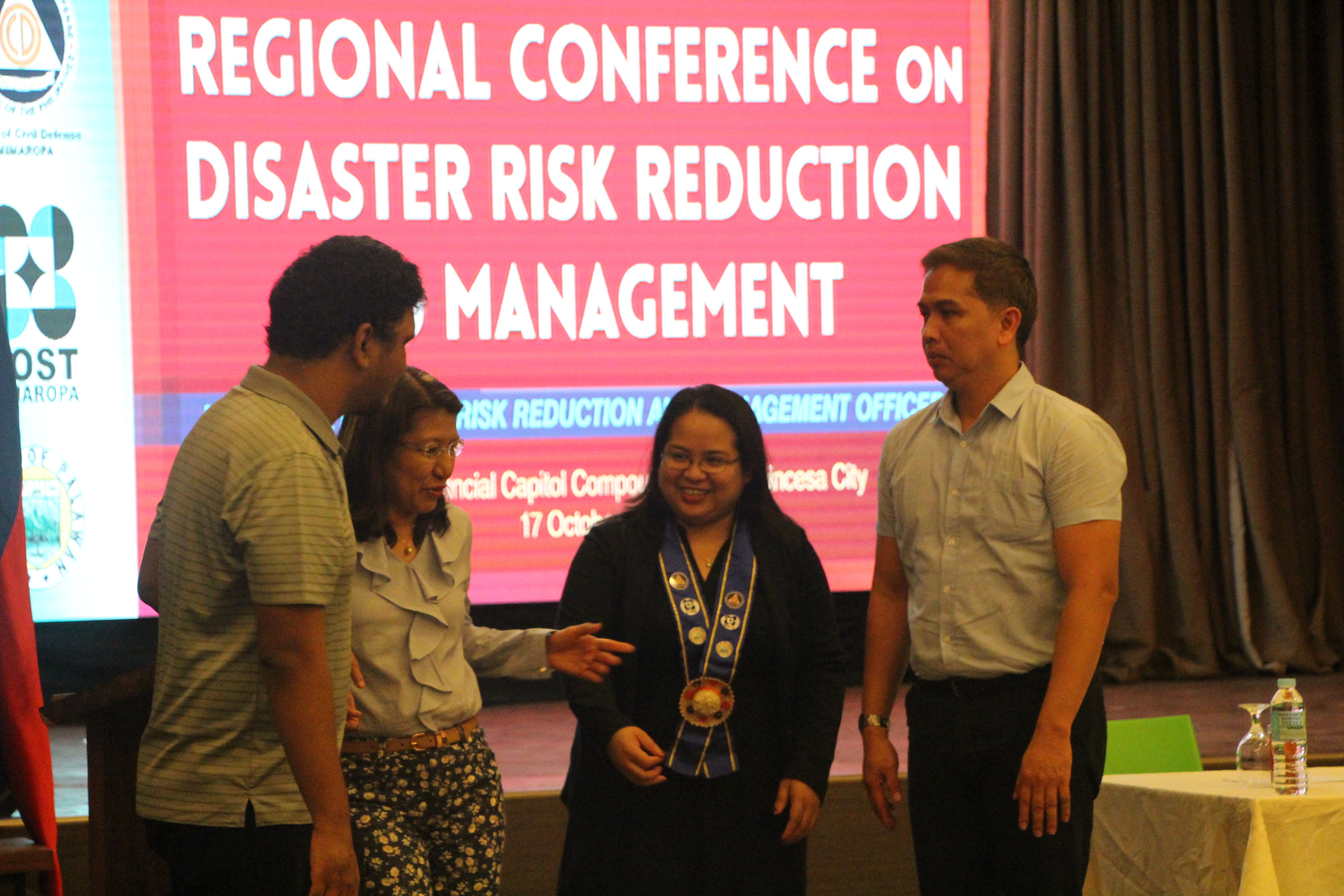
The UP Phil-LiDAR 1 is privileged to have been invited as resource speaker to the Regional Conference on Disaster Risk Reduction and Management of Mindoro Marinduque Romblon Palawan or MIMAROPA Region on October 17, 2017 held at the VJR Hall Provincial Capitol of Puerto Princesa City.
Read the full postIdi Nagsabat ken Nalawagan ti Syensya ken Kultura idiay Kalinga (When Science and Culture met and Shines in Kalinga) Regional Science and Technology Week CAR in Tabuk, Kalinga
- Posted by Aian Umiibig Perucho
- on 14 October 2017
- 0 Comments
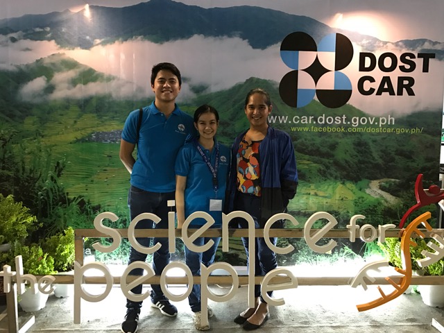
Cordillera, the land of strong preservation of culture. It was known for its beautiful mountainous land that has mineral reserves and the main source of peoples livelihood. Crop and vegetable production through slash and burn method of farming is the main livelihood of Cordillera people for the longest time. Years gone by, people learned how to cultivate their local product to organic bases. With this, the region have known to be one of the best cultivator of organic local products all over the Philippines. For them to be known, DOST CAR launched Regional Science and Technology Week every year. For the first time, the event this year was hosted and shone in the province of Kalinga.
Read the full postMGB & PAGASA Personnel Receive Training on LiDAR
- Posted by Nur Hussain S. Maba
- on 14 September 2017
- 0 Comments
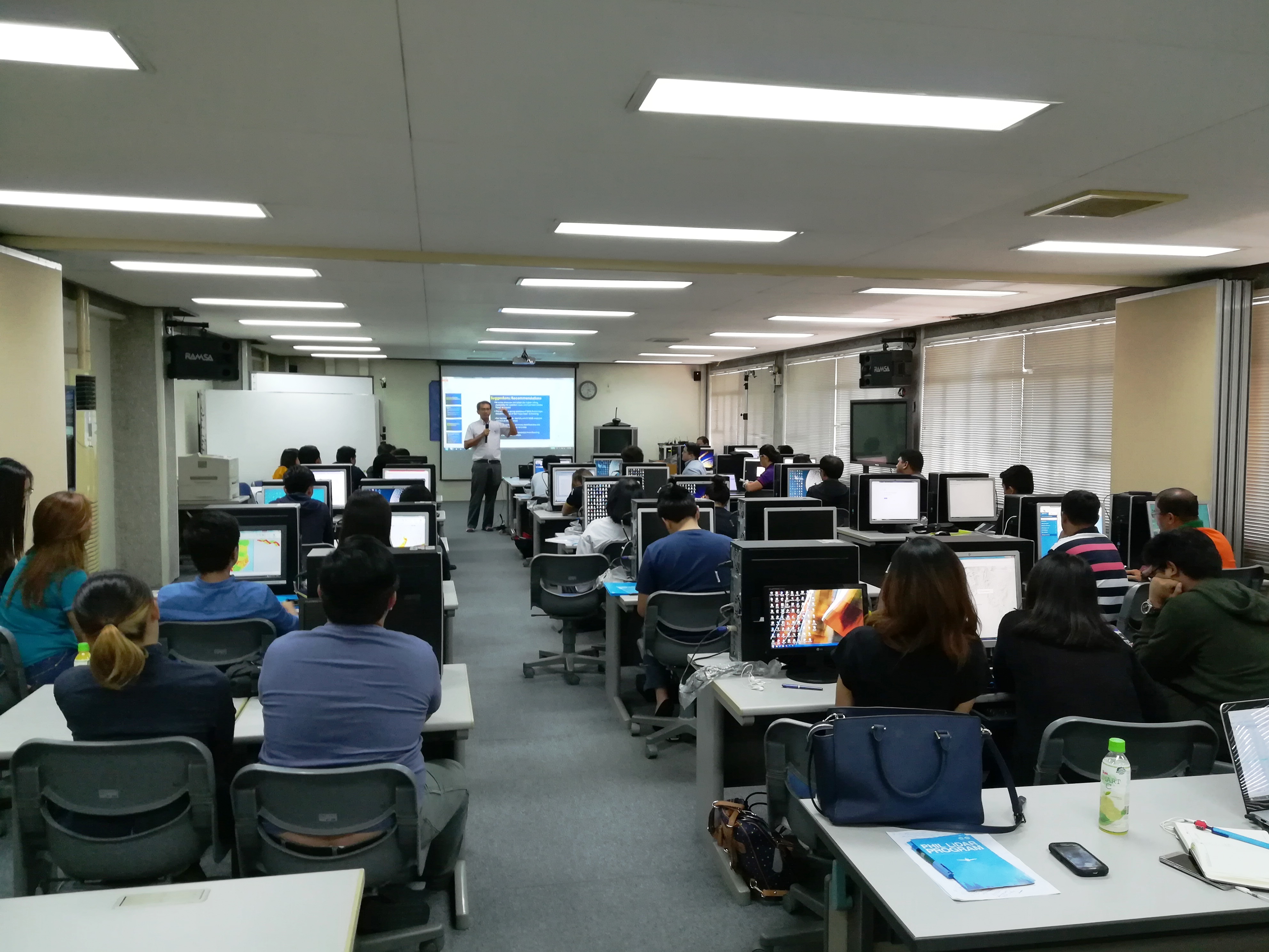
In line with the closing of the PHIL-LiDAR 1 Program this year, a training to the Philippine Atmospheric Geophysical Astronomical Services Administration (PAGASA) and Mines Geosciences Bureau (MGB) personnel as the receiving agencies was conducted on September 11-14, 2014 at the JICA room of the National Engineering Center of University of the Philippines Diliman. The training entitled “Flood Modeling and Mapping Training” was facilitated by the Flood Modeling Component of PHIL-LiDAR 1 headed by Chief Science Research Specialist Christopher Uichanco along with his team. Dr. Enrico C. Paringit, the Program Leader was also present throughout the four-day training in support to the event who also added valuable insights on the core mission of the program, use of the technology, and flood map harmonization forum, which took place on the last day of the training.
Read the full postUP Diliman Receives Latest Campus Map Using LiDAR
- Posted by Nur Hussain S. Maba
- on 24 August 2017
- 0 Comments
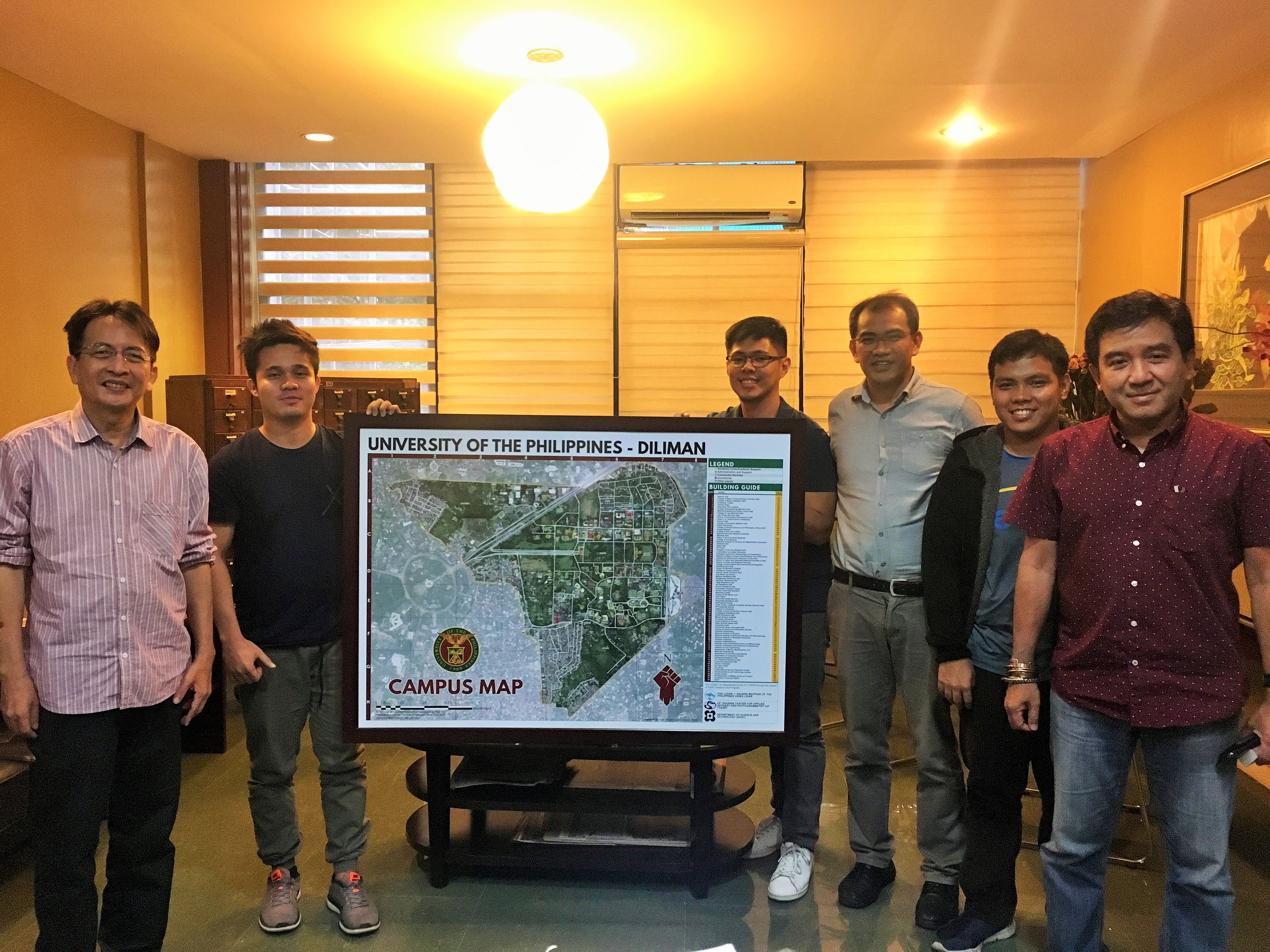
The PHIL-LiDAR 1 Program headed by the Program Leader Dr. Enrico C. Paringit together with the Data Pre-Processing Component (DPPC) members: Harmond Santos, Senior Science Research Specialist; Research Associates Alex John Escobido and Vincent Louise Azucena endorse the latest UP Campus Map to Chancellor Michael Tan.
Read the full postUP PHIL-LiDAR 1 Attends State of the City Address (SOCA) in Dagupan City
- Posted by Nur Hussain S. Maba
- on 17 July 2017
- 0 Comments
The UP PHIL-LiDAR 1 is honored to have been invited by the local government unit (LGU) of Dagupan City to this year's State of the City Address (SOCA) held in CSI Stadia, Dagupan City on July 17, 2017. Attendees from the UP PHIL-LiDAR 1 were: Ernanie Marin, Research Associate of Data Archiving & Distribution (DAD) Component, Gianni Mari Sumajit, Research Associate of Flood Modeling Component (FMC), Nur Hussain S. Maba of Training Component, and Santiago dela Cruz of Admin.
Read the full post
Like Us on Facebook
Facebook