Partnering for Change, Engaging the World: The Phil-LiDAR Program Conducts Training on LiDAR Applications for the ASEAN Region
- Posted by Beau Alambra Estepa
- on 3 July 2017
- 0 Comments

As the Association of Southeast Asian Nations (ASEAN) enthusiastically celebrates its 50th year, the Philippines encapsulates its chairmanship of the ASEAN this year with the theme “Partnering for Change, Engaging the World.” In coordination with the ASEAN Sub-Committee and Space Technology and Applications (SCOSA) and the ASEAN Regional Training Centre for Space Technology and Applications (ARTSA), the Philippines seeks to highlight activities that will foster camaraderie among the ASEAN nations towards reaching the common goals of regional resilient development and solidarity.


In this light, the training workshop on “LiDAR Applications on Disaster Risk and Natural Resource Management for the ASEAN Region” was conducted by the Phil-LiDAR Program in partnership with the Department of Science and Technology (DOST) – Philippine Council on Industry, Energy, and Emerging Technology Research and Development (PCIEERD). The event was held on June 26 – 30, 2017 at the National Engineering Center (NEC), University of the Philippines Diliman, Quezon City, Philippines.

Dr. Aaron Joseph Villaraza, Deputy Director of the UP Diliman Office of International Linkages
 (Phil-LiDAR 2 Track, DAY 2)")
Chief Science Research Specialist For. Nerissa B. Gatdula On Advanced Geographic Information Systems (GIS) (Phil-LiDAR 2 Track, DAY 2)
The objectives of the training were the following:
- To create awareness among the participants of the value, uses and applications of LiDAR technologies particularly on disaster risk reduction and resource assessment.
- To train the ASEAN Participants in the generation of flood hazard maps and instruct its usage in Planning, Disaster Preparation, and Engineering purposes.
- To train the participants on the following LiDAR applications: agricultural, coastal, forest, hydrological, and renewable energy for resource assessment.
- To disseminate knowledge on the generation, application and uses of LiDAR data, such as digital elevation models (DEMs), digital surface models (DSMs), and orthoimages.
- To explain to the participants the Philippine’s flood hazard maps and their tandem with real-time sensor data in the set-up early-warning system.
- To familiarize the participants with the uses and applications of online rain gauges and water level forecast system (WLFS) information.
- To provide a collaborative environment among the ASEAN representatives through informative exchange of information and group workshops.
 Extraction and Mangroves Extraction Using LiDAR Derivatives (Phil-LiDAR 2 Track, DAY 3)")
Chief Science Research Specialist Engr. Charmaine A. Cruz assisting an ASEAN delegate on lab exercises: Aquaculture (Fishpond) Extraction and Mangroves Extraction Using LiDAR Derivatives (Phil-LiDAR 2 Track, DAY 3)
The objectives of the training were accomplished accordingly:
For objective #1, the participants were made aware of the value, uses, and applications of LiDAR technologies since DAY 1 of training, especially from the lectures “Disaster Risk Applications Using LiDAR” by Dr. Enrico C. Paringit and “Natural Resource Applications of Airborne LiDAR” by Engr. Ma. Rosario Concepcion O. Ang which were discussed in-depth on DAY 2, 3, 4, and 5 by trainers of the Phil-LiDAR Program.
For objective #2, The ASEAN participants were trained in “Flood Modeling and Mapping Using LiDAR” by Dr. Enrico C. Paringit and “Flood Hazard Mapping” with lab exercise on “RAS (River Analysis) Mapping” by Ms. Sylvia A. Sueno; the ASEAN participants were also trained on “Vulnerability Assessment” with lab exercise on “Flood Risk Profiling” by Mr. Neil Tingin. The ASEAN participants were trained on the uses and application of flood hazard maps in planning through the group project “Integration of Existing Datasets for Flood Hazard and Vulnerability Assessment” facilitated by Mr. Christopher Noel L. Uichanco.

Research Associate Klaribelle Anne Languayan with Heng Chivy and Vichiet Him of Cambodia
")
Chief Science Research Specialist Engr. Joemarie Caballero Discussing Challenges, Solutions Applied, and Recommendations On Data Validation and Bathymetry (Phil-LiDAR 1 Track, DAY 2)
For objective #3, the participants were trained on “Agricultural Resources Extraction Using OBIA“ on DAY 2 by Engr. Eric Luis M. Tañada and Engr. Mark Sueden Lyle Y. Magtalas, “Mapping Aquatic Resources” on DAY 3 by Engr. Charmaine Cruz and Engr. Rudolph V. Peralta with lab exercises on “Aquaculture (Fishpond) Extraction Using LiDAR Derivatives” and “Mangroves Extraction Using LiDAR Derivatives” by Engr. Peralta and Engr. Rey L. Jalbuena, “Forest Resource Extraction from LiDAR Surveys” on DAY 3 by For. Reginald Argamosa, “Hydrological Feature Extraction” by Engr. Roel M. de la Cruz and “Renewable Energy Sources Mapping from LiDAR Surveys” with a hands-on training on “Solar Energy Resource Assessment Using LiDAR-derived DSM and GRASS GIS” on DAY 4 by Engr. Ma. Rosario Concepcion O. Ang.
 Extraction Using LiDAR Derivatives (Phil-LiDAR 2 Track, DAY 3)")
Senior Science Research Specialist Engr. Rudolph V. Peralta conducting the lab exercise Aquaculture (Fishpond) Extraction Using LiDAR Derivatives (Phil-LiDAR 2 Track, DAY 3)
")
Senior Science Research Specialist Patrizcia Mae dela Cruz assisting ASEAN delegates on Data Validation and Bathymetry Output Processing (Phil-LiDAR 1 Track, DAY 2)
For objective #4, knowledge on generation of LiDAR data was disseminated on DAY 2: “DATA ACQUISITION” by Engr. Louie P. Balicanta (LiDAR System) and Engr. Christopher S. Cruz (Flight Planning and LiDAR Survey Procedures) furthered with lab exercise on “Flight Plan, Flight Maps, and Simulation of Flight” by Ms. Lovely Gracia C. Acuña. Knowledge on “LiDAR Data Pre-processing,” “LiDAR Data Error and Accuracy,” “Representations of LiDAR Data,” and “Raster Data and DEMs” were disseminated on DAY 3 by Engr. Sarah Jane D. Samalburo furthered with lab exercise on “DEM Processing (DSM vs. DTM),” “Visualization of LiDAR DEMs Data” and “Terrain Analysis” were disseminated on DAY 3 by Engr. John Louie D. Fabila furthered with lab exercise on “Extracting and Interpreting Terrain Attributes Using QGIS.” Knowledge on “Extraction of Features” was disseminated by Engr. Ma. Rosario Concepcion O. Ang furthered with lab exercise on “Feature Digitization and Attribution.”
For objective #5, the tandem of the Philippines’s flood hazard maps with real-time sensor data in the set-up of early warning system was explained to the participants on DAY 1 on the lecture “Disaster Risk Reduction Applications Using LiDAR” by Dr. Enrico C. Paringit which was later reiterated and furthered on DAY 2 through “Field Survey Techniques” by Engr. Louie P. Balicanta with “Equipment Demo” by Engr. Kristine Ailene B. Borromeo, “Output Processing” by Engr. Romalyn Francis P. Boado, “Challenges Solutions Applied, and Recommendations” by Engr. Joemarie Caballero and then discussed in-depth on DAY 4: “USES AND APPLICATION OF FLOOD HAZARD MAPS IN DISASTER PREPARATION AND FLOOD EVENT MANAGEMENT” through “Flood Hazard Mapping” by Ms. Sylvia A. Sueno and “Vulnerability Assessment” by Mr. Neil Tingin and finally reinforced through the group project “Integration of Existing Datasets for Flood Hazard and Vulnerability Assessment” facilitated by Mr. Christopher Noel L. Uichanco.
")
Chief Science Research Specialist Engr. Roel M. de la Cruz On Hydrological Feature Extraction (Phil-LiDAR 2 Track, DAY 4)
For objective #6, the participants were familiarized with the uses and applications of online rain gauges and water level forecast system (WLFS) information on DAY 4: “USES AND APPLICATION OF FLOOD HAZARD MAPS IN DISASTER PREPARATION AND FLOOD EVENT MANAGEMENT” through “Flood Hazard Mapping” with lab exercise on “RAS (River Analysis System) Mapping” by Ms. Sylvia A. Sueno and “Vulnerability Assessment” with lab exercise on “Flood Risk Profiling” by Mr. Neil Tingin.
For objective #7, Informative exchange of information has been achieved since DAY 1 of the training. Representatives of ASEAN member states were tasked to present fast facts of their respective countries: land area, population, topography, climate, urban and rural areas, and then their form of government, previous challenges and efforts on disaster risk management and natural resource management, and then finally their nature of work or study in their respective institutions.

 monitoring the progress of the ASEAN Delegates On the Integration of Existing Datasets for Flood Hazard and Vulnerability Assessment (Phil-LiDAR 1 Track, DAY 5)")
Chief Science Research Specialist Christopher Noel L. Uichanco (standing, left) monitoring the progress of the ASEAN Delegates On the Integration of Existing Datasets for Flood Hazard and Vulnerability Assessment (Phil-LiDAR 1 Track, DAY 5)
ASEAN representative were encouraged to break out into two (2) groups: one to be trained on LiDAR applications on disaster risk management while the other on natural resource management. This means that an ASEAN member state is represented in both groups. Representatives were able to interact and collaborate among different nationalities in their respective groups.
")
Research Associate Engr. Regis R. Guhiting assisting ASEAN delegates on the Visualization of LiDAR DEMs Data and Terrain Analysis (Phil-LiDAR 1 Track, DAY 3)
Lab exercises on DAYS 2, 3, and 4 were done individually. Each representative was assigned a 1 km x 1 km tile with with which to process LiDAR data. On DAY 5: "Integration of Existing Datasets for Flood Hazard and Vulnerability Assessment" and "Natural Resource Assessment of Cagayan De Oro, Philippines," ASEAN representatives would later find out that their assigned tiles, when pieced together, form contiguous areas. The two (2) breakout groups were able to collaborate and create respective flood hazard and natural resource maps which were presented as part of the ASEAN LiDAR Training's culminating activity.
 (Phil-LiDAR 2 Track, DAY 2)")
Senior Science Research Specialist Daniel Marc Dela Torre assisting ASEAN delegates On Agricultural Resources Extraction Using Object-based Image Analysis (OBIA; Phil-LiDAR 2 Track, DAY 2)
There were a total of 59 education topics discussed in the training under the following headings:
Phil-LiDAR 1 Track:
- Data Acquisition (DAY 2)
- Data Validation and Bathymetry (DAY 2)
- Basics of Using LiDAR Data (DAY 3 and 4)
- Uses and Application of Flood Hazard Maps in Disaster Preparation and Flood Event Management (DAY 4)
Phil-LiDAR 2 Track:
- OBIA/GIS/LASTOOLS (DAY 2)
- Agricultural Resources Extraction Using OBIA (DAY 2)
- Mapping Aquatic Resources (DAY 3)
- Forest Resource Extraction from LiDAR Surveys (DAY 3)
- Hydrological Feature Extraction (DAY 4)
- Renewable Energy Resources Mapping from LiDAR Surveys (DAY 4)

Philippine delegate Engr. Leonard Philip A. Bangco of DOST-PCIEERD training under the Phil-LiDAR 1 Track
There were a total of two (2) research topics tackled on DAY 5:
Phil-LiDAR 1 Track:
- Uses and Application of Flood Hazard Maps in Planning: Integration of Existing Datasets for Flood Hazard and Vulnerability Assessment
Phil-LiDAR 2 Track:
- Natural Resource Assessment and Mapping Using LiDAR: Natural Resource Assessment of Cagayan De Oro Philippines
There were a total of 27 speakers and resource persons during the 5-day training, including Engr. Raul Sabularse (Chair of the ASEAN Sub-Committee on Space Technology and Applications), Dr. Leah J. Buendia (DOST Assistant Secretary for International Cooperation), and Dr. Aaron Joseph L. Villaraza (Deputy Director of UP Diliman Office of International Linkages).
")
Heng Chivy of Cambodia presenting his flood mapping output During the Final Report Presentation and Culminating Activity (DAY 5)
A total of 17 participants underwent ASEAN LiDAR Training:
From the Kingdom of Cambodia Ministry of Land Management, Urban Planning and Construction are:
- Him Vichiet, Deputy Director of the Department of Cadastral Information Technology
- Ro Narith, Chief of GIS Office
- Hong Hei, M. Sc., Chief of Administration Boundary Office
- Yeang Dane, Chief of Training and Risk Management Office
- Heng Chivy, Chief of Study Office
The delegates of the Lao People's Democratic Republic are:
- Silap Boupha, Director of the Department of Planning and Cooperation
- Oulaphone Ongkeo, Head of Natural Resource and Environment Center
- Sisouk Boundathip, Technical and Teller GIS of the National University of Laos
- Sombath Douangsavanh, Technical Officer of the Ministry of Labour and Social Welfare
- Daovilay Banchongphanith, Disaster Coordinator of the Ministry of Health
The delegates of the Socialist Republic of Vietnam Ministry of Natural Resources and Environment are:
- Nguyen Van Minh, M. Sc., Vice Director of Remote Sensing for Map Establishing and Updating
- Vu Van Phong, M. Sc., Head of Technical Planning Division Center
- Trin Viet Ngah, M. Sc., Vice Director of Center for Remote Sensing
From the National University of Singapore, Republic of Singapore:
- Huang Xiaojing, Researcher
- Yang Chin-jung, M. Eng. Associate Scientist
The delegates of the Republic of the Philippines are:
- Engr. Leonard Philip A. Bangco, Science Research Specialist 1 of the Department of Science and Technology
- Ariane G. Jaraplasan, Science Research Specialist 1 of the Department of Science and Technology
The culminating activity of the ASEAN LiDAR Training was held in the NEC-AVR. The breakout groups presented their respective flood mapping and natural resource assessment outputs and then followed by an open forum.
Each participant was then awarded with a certificate of completion. Heng Chivy, Hong Hei, and Yeang Dane of Cambodia delivered messages of thanks and related their learning experiences. Dean Rizalinda L. De Leon of the UP College of Engineering gave a message of appreciation on behalf of the Naitonal Engineering Center. The event was formally closed by Engr. Raul Sabularse.
The ASEAN LiDAR Training has fostered camaraderie among the ASEAN nations towards reaching the common goals of regional resilient development and solidarity.
 During the Awarding of Certificates of Completion")
Delegates from the Kingdom of Cambodia pose with Engr. Raul Sabularse and Dr. Enrico Paringit (2nd and 3rd from left) during the Awarding of Certificates of Completion

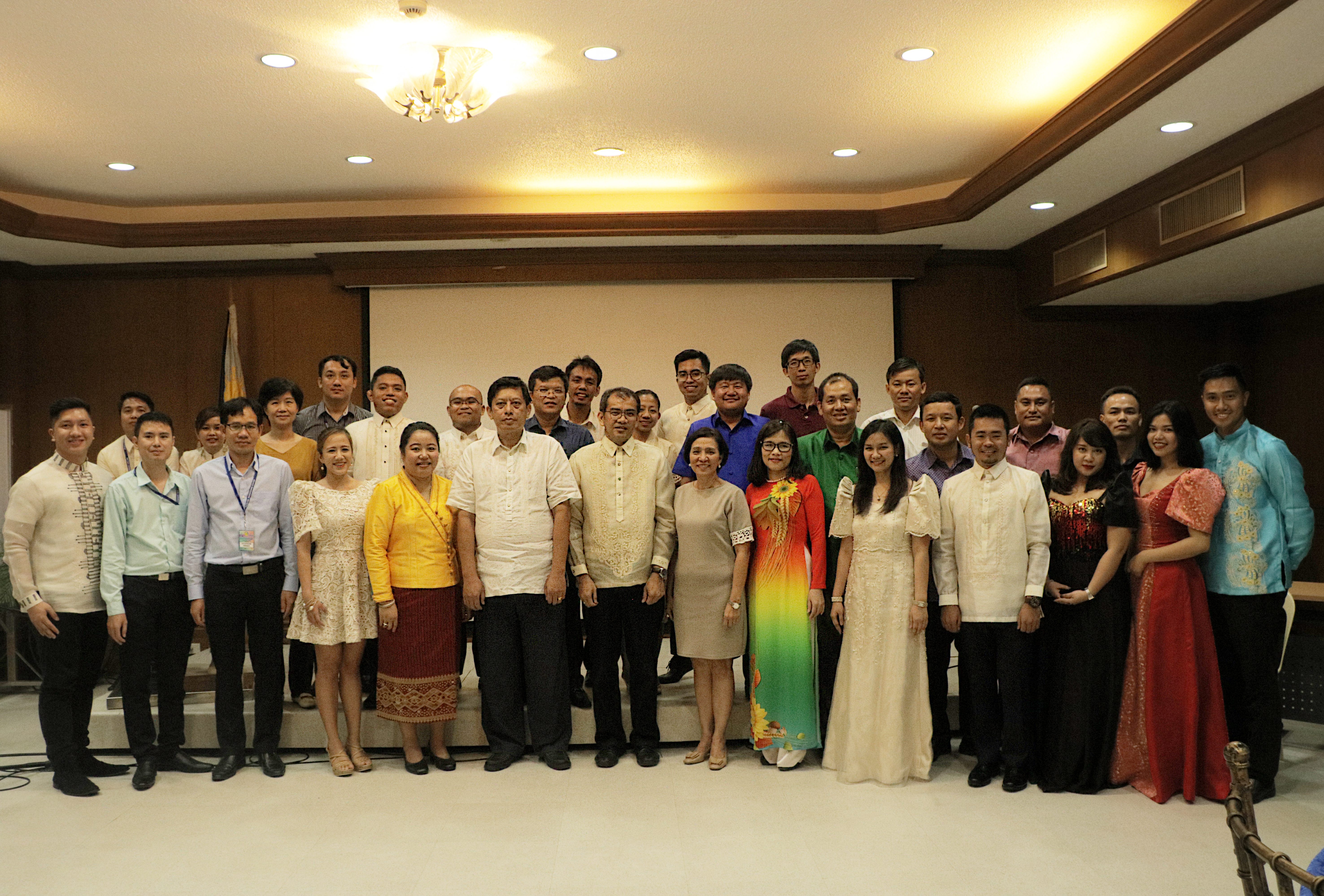
 And ASEAN SCOSA Chairperson Engr. Raul Sabularse (center; wearing glasses) And trainers from the Phil-LiDAR 1 and 2 Programs.")
Participants of the ASEAN LiDAR Training pose with Phil-LiDAR 1 Program Leader Dr. Enrico C. Paringit (center) And ASEAN SCOSA Chairperson Engr. Raul Sabularse (center; wearing glasses) And trainers from the Phil-LiDAR 1 and 2 Programs.
S
enior Scie nce Research Specialist Engr. Therese Anne M. Rollan
On OBIA for Land Cover Classification (Phil-LiDAR 2 Track. DAY 2)
Like Us on Facebook
Facebook