UP Baguio Phil-LiDAR 1 Turns Over Flood Hazard Maps to Region I and CAR LGUs
- Posted by Beau Alambra Estepa
- on 7 January 2017
- 0 Comments
The Luzon Cluster of the Phil-LiDAR 1 Program held its 4th conference and flood hazard maps turnover at the Marco Polo Function Room of El Cielito Inn, Baguio City on January 5-6, 2017. The host state university for the two-day event was University of the Philippines Baguio (UPB) headed by Dr. Chelo S. Pascua, Project Leader of UPB Phil-LiDAR 1.
Read the full postPhil-LiDAR 1 Program concludes 2016 with Year-End Assessment Training
- Posted by Di-Ann Suarez
- on 19 December 2016
- 0 Comments
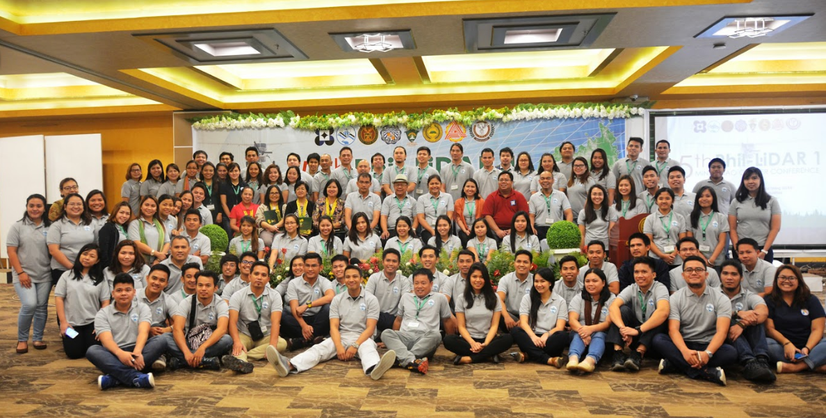
The PHIL-LiDAR 1 – Hazard Mapping of the Philippines Using LiDAR Program conducted its annual Year-end Assessment on December 19, 2016 at the La Breza Hotel in Quezon City. The program was attended by a total of 146 of its 160 personnel including the program leader, project leaders, chief science research specialists, (CSRS), senior and supervising science research specialists, research associates and administrative personnel. The sessions were facilitated by Mr. Alvin P. Principe, a Fellow of the Development Academy of the Philippines’ Center for Governance and designated as the Director of the Operations Management Office with expertise on topics such as strategic and operations planning, project development and management, organizational assessment and development, leadership and management development, and process reengineering.
Read the full postPhilippine National LiDAR Conference Online Registration
- Posted by Admin
- on 12 December 2016
- 0 Comments

Registration for the Philippine National LiDAR Conference may be done through the following link:
Read the full postLuzon Partner Universities Converged in Dagupan for 3rd Luzon Cluster Conference
- Posted by Mae A. Valdez
- on 9 December 2016
- 0 Comments

The 3rd Luzon Cluster Conference and Data Turnover Ceremony was held on December 1-2, 2016 in Dagupan City, Pangasinan. Hosted by the Central Luzon State University’s Institute for Climate Change and Environmental Management (CLSU-ICCEM), the event was attended by local government officials from Region 1.
Read the full postPHIL-LiDAR 1 Programs Wraps Up the 5th Mindanao Cluster Conference
- Posted by Klaribelle Anne Languayan
- on 9 December 2016
- 0 Comments
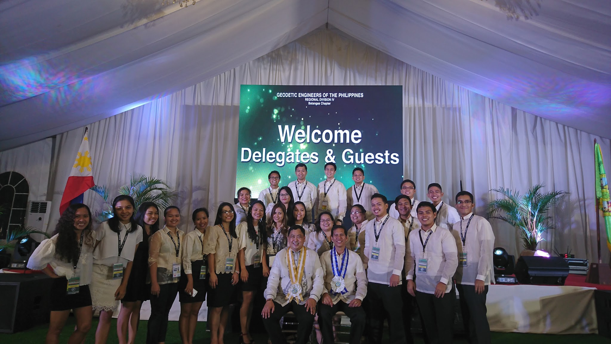
Phil-LiDAR 1 & 2 Participate in the 8th MGA Conference Held in Manila
- Posted by Nur Hussain Maba
- on 21 November 2016
- 0 Comments
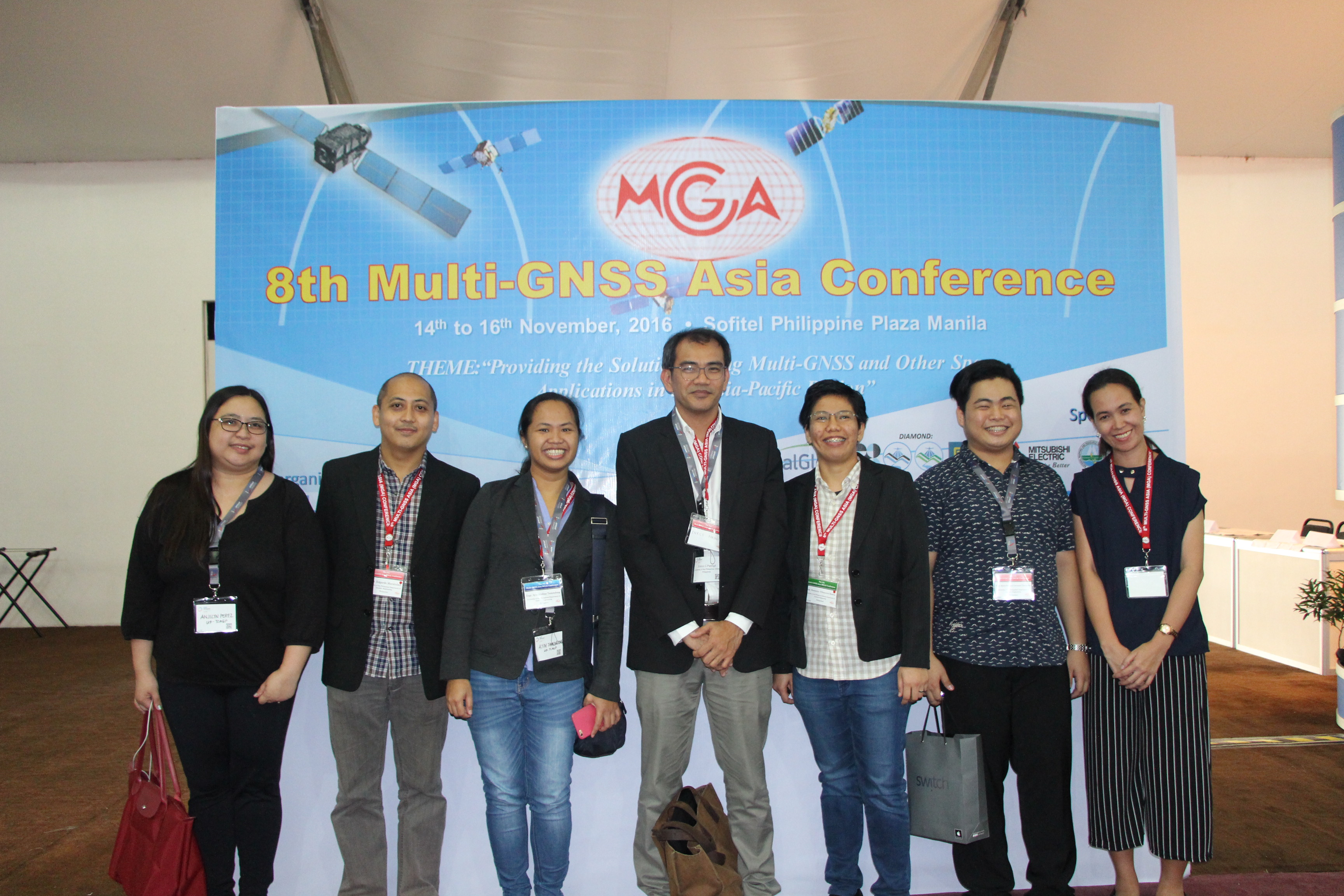
The UP Phil-LiDAR 1 and 2 attended the recently concluded 8th MGA Conference 2016 held in Sofitel Hotel, Manila on November 14-16, 2016. The conference this year had the theme, “Providing the Solutions using Multi-GNSS and Other Space Applications in the Asia-Pacific Region”, expanding the development of solutions beyond GNSS but as well as including related technologies such as remote sensing and big data analysis relevant for Asia-Pacific region. Our very own Engr. Louie Balicanta, Project Leader of DVBC co-chaired the Local Organizing Committee. The event was jointly organized by BELS, GNSS Asia, JAXA, DOST (PHIVOLCS), NAMRIA, and sponsored by LiDAR 1&2, University of the Philippines, Digital Globe, DOST, Mitsubishi Electric, QZSS Services, Certeza, GSMi, Kokusai Kogyo Co., and PASCO Philippines.
Read the full postVSU Hosts Visayas Cluster Conference and Data Turnover Ceremony
- Posted by
- on 16 November 2016
- 0 Comments
The PHIL LiDAR 1 Visayas Cluster Conference and Data Turnover Ceremony was conducted in Visayas State University, Baybay campus in Leyte on November 10-11, 2016. The event catered to both external and internal stakeholders of the program by providing a venue to present the significance of the program’s outputs to efforts on disaster preparedness and local government planning, distribute flood hazard maps to local government units within the region and orient local officials on the basic features of the maps and how to access them through the LiPAD website. The business meeting conducted on the second day provided a venue for PHIL LiDAR SUCs/HEIs within the Visayas region to discuss their outputs, set targets on program deliverables and schedules as well as to identify gaps on program implementation and recommend possible solutions. The first day was attended by local government officials, representatives from DOST-PCIEERD, as well as representatives from the NGO sector and Engineering students. PHIL-LiDAR 1 personnel from UP Diliman, Visasyas State University, UP Cebu and University of San Carlos.
Read the full postPHIL-LiDAR 2 Orientation with Forest Conservation Officials from the People’s Republic of Bangladesh
- Posted by Mae Valdez
- on 20 October 2016
- 0 Comments
The Forest Resources Extraction from LiDAR Survey (FRExLS) component of the PhiLiDAR 2 program briefed officials from the People’s Republic of Bangladesh Ministry of Environment and Forests on how LiDAR can be utilized for forest resource management. This study visit was a part of a training program in the University of the Philippines- Los Baños (UPLB) sponsored by the World Bank. The group was accompanied by UPLB’s College of Forestry and Natural Resources’ Ms. Analyn Cadilan and Ms. Vanessa Palma. The purpose of the activity was to enable the trainees to know how Light Detection and Ranging (LiDAR) can be used to map forest resources and provide data on policy formulation, planning and management. This was held in the Executive Board Room of the National Engineering Center, UP Diliman on October 20, 2016.
Read the full postCALL FOR ABSTRACTS NOW OPEN
- Posted by Mae Valdez
- on 12 October 2016
- 0 Comments
The overall theme of the 2017 National LiDAR Conference is "On the Cutting Edge: Geospatial Technology at the Forefront of Disaster Risk Reduction and Natural Resource Management in the Philippines".
PHIL-LiDAR 1 Graces Data Turnover in Isabela State University
- Posted by Nur Hussain Maba
- on 19 September 2016
- 0 Comments
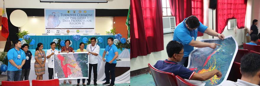
The UP PHIL-LiDAR 1 team successfully concluded the data turnover in Isabela State University-Echague campus (Isabela Province) on September 19, 2016 headed by Engr. Rosario Concepcion O. Ang, Project Leader of Data Pre-Processing Component. The new director of DOST Region II, Engr. Sancho A. Mabborang, opened the event. Over 100 guests attended coming from 60 LGUs of Cagayan, Isabela, and Quirino Province. The city mayor of Echague, Francis Faustino A. Dy gave a welcome message and expressed his warm support to the LGUs on disaster risk reduction management especially concerning flooding knowing that Isabela is one of the most prone to natural hazards in the world.
Read the full post
Like Us on Facebook
Facebook